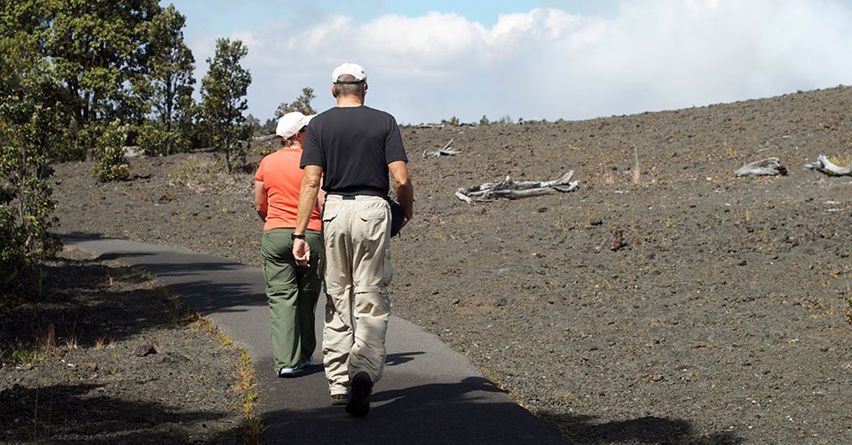
A volcano does not stop changing when an eruption ends. At Devastation Trail, you can walk through a place buried by cinders in 1959 and watch how vegetation has returned. The contrast between black volcanic fragments and recovering green growth gives the trail a clear reason to visit even when no lava is visible.
The National Park Service describes an easy one-mile round trip on a paved path between the Devastation Trailhead and Puʻupuaʻi area, with approximately 30–60 minutes for the walk. There are sections of pavement steeper than an eight-percent grade. It is listed as wheelchair and stroller accessible, but that does not guarantee every person can navigate every slope comfortably. Read NPS trail guidance.
Choosing a trailhead and walking direction
NPS lists both the Devastation Trail and Puʻupuaʻi parking areas along Crater Rim Drive as entrances. The walking experience is similar either way; the more important choice is whether your group wants an out-and-back walk or plans to connect with another longer trail. If a lot is full, never park in a no-parking area or along vegetation just to shorten the walk.
Choose one parking lot, walk the paved route, reach the far side, then retrace your steps unless you have clearly planned a legal connecting route. The full mile includes the return; it is not one mile in each direction.
What happened here in 1959?
The 1959 Kīlauea Iki eruption showered the surrounding landscape in hot cinders and built Puʻupuaʻi, a cinder and spatter cone. What looks sparse or barren today is part of an ongoing natural recovery. Old photographs can help visitors understand why the forest and crater look different from one another.
Look for the changes in plant cover as you move along the paved route. There is no need to step into the cinder field to examine a seedling. Some fragile recovery areas are easily damaged by footprints, and NPS specifically prohibits climbing Puʻupuaʻi.
Is the trail a good choice for a family or limited mobility?
Compared with the uneven lava at Puʻuloa Petroglyphs, this is a less technical surface. It works well for a family seeking a shorter outing or travelers trying to avoid steep unpaved trails. However, the published eight-percent-plus grades mean wheelchair users or people relying on walking aids should assess the route and, when needed, request the latest accessibility details from park staff.
Rain and strong wind can change the experience considerably. Wear shoes with grip, bring a layer and plan a realistic turnaround if any member of the party is uncomfortable.
Protect nēnē near the roadside
You may encounter nēnē, the protected Hawaiian goose, close to trailheads and roads. These birds can become habituated to food, increasing the danger of vehicle strikes. Keep food put away, never offer a treat and slow down around wildlife. A quiet, distant photograph is preferable to coaxing a bird closer.
The NPS highlights vehicle collisions and human feeding as serious threats to nēnē. Follow park rules and leave room for other visitors and animals.
Pair it with one other summit-area stop
For a light itinerary, pair Devastation Trail with an officially open crater overlook. For a more demanding day, it can be a warm-up before Kīlauea Iki—but avoid assuming the easy mile is effortless after a long crater loop. Park conditions and trail connections change, so check the map rather than improvising a shortcut.
For visitors sensitive to volcanic fumes, the paved Devastation route may be a more comfortable choice than Haʻakulamanu Sulphur Banks, which carries specific gas-exposure warnings.
Sources and review: November 2, 2026. NPS Devastation Trail and NPS place information. Check current park conditions. Featured hikers photograph: National Park Service, public domain.